


Description
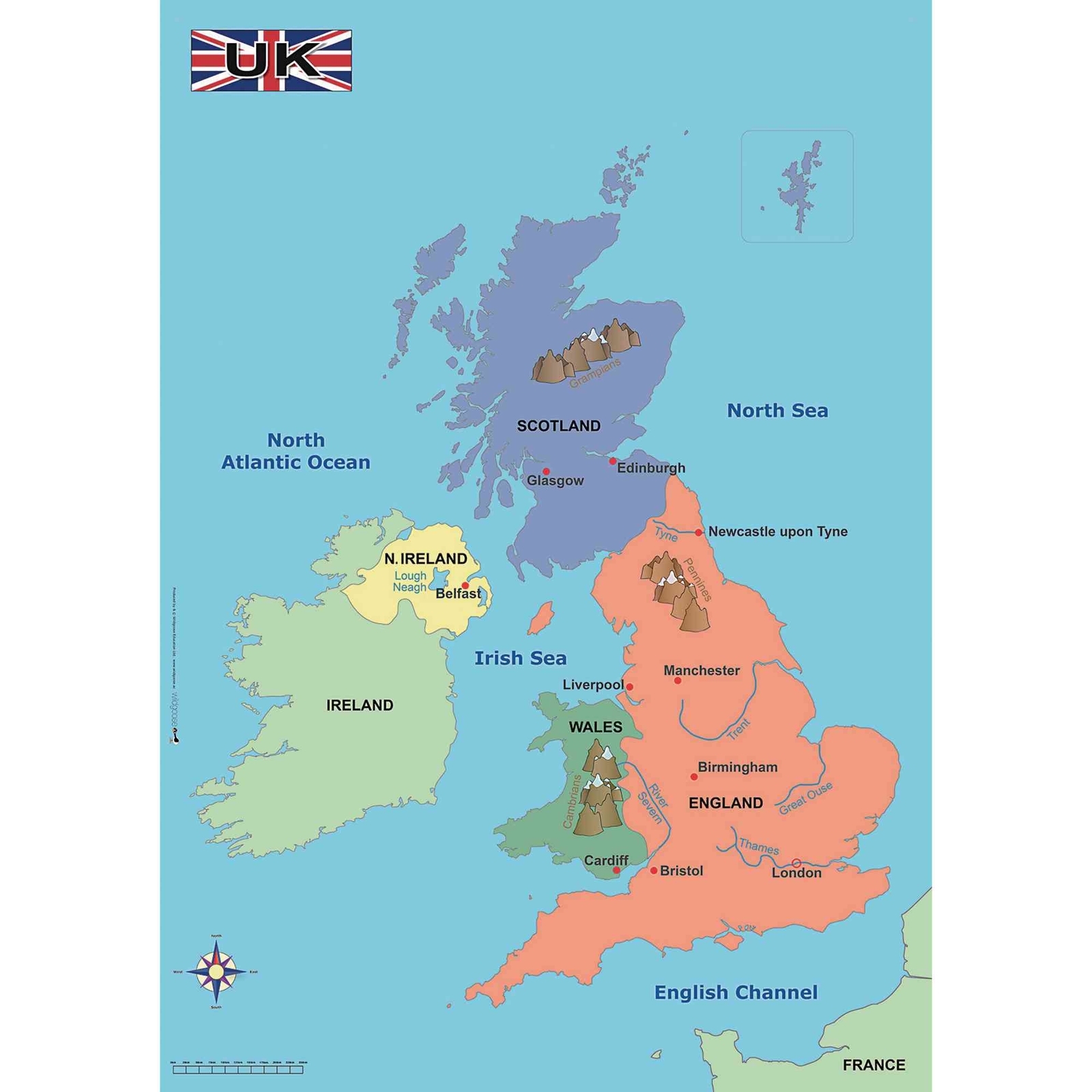
This simple map of the UK shows principal towns and cities seas rivers and mountains. Each of the British Isles is shown in a different colour making this perfect for both KS1 and KS2 studies of the UK contrasting localities or Maps and Mapping. Size: 570mm x 670mm.
- Clear and concise details
- Shows main cities towns and physical geography
- 570mm x 670mm
Specifications
Made In
GB
Brand
Own Brand
Categories
Geography
Category
Maps & Compasses
